This amazing walkable world map took more than 25 years to build
Walking the globe would take you 11 years – that is, if you could walk on water. However, a miniature world map in Denmark makes it possible for you to walk around the globe in a few minutes.
Verdenskortet, or world map, is a walkable map that is made of soil and stone, built on top of a pond. Søren Poulsen completed the project after two decades of hard work, according to Inhabitat.
Poulsen was born in 1888 in Denmark and realized a stone on his land looked similar to the Jutland Peninsula. That single stone led him to create a world map. Poulsen started the project in 1944. Using just hand tools, a pushcart and a wheelbarrow, he made the map out of rocks and dirt.
loading...
He kept working on the map until his death in 1969.
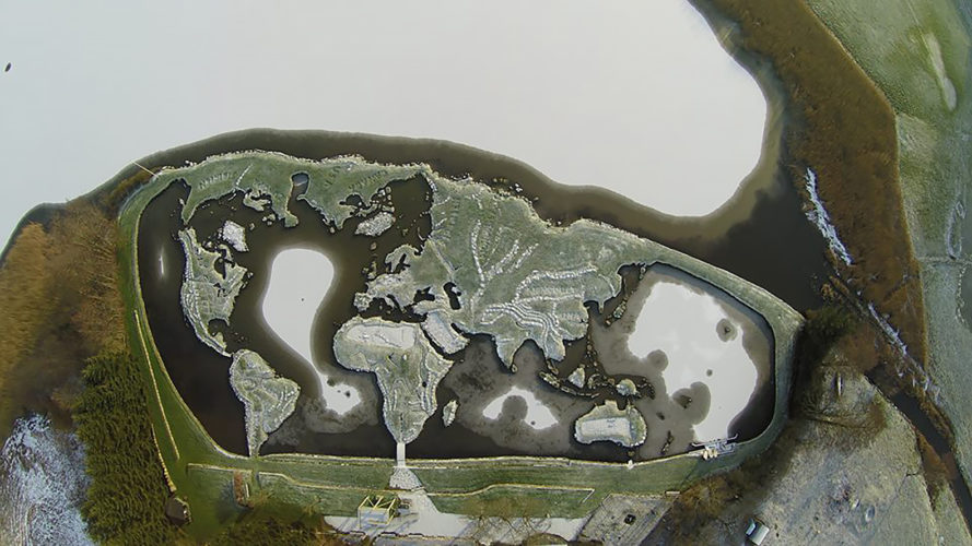
The stones comprising the world map were moved onto the ice during winter, and moved back into place in spring, according to the Verdenskortet Facebook page. Each country is marked by flags.
America is divided by yellow bricks into states. The equator is marked by red poles. The world map is 300 feet by 150 feet, and each 10 inches represent 69 miles in reality.
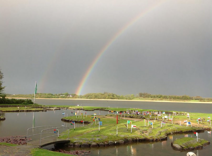
Today, the map is the center of a park that offers outdoor activities and event space. Approximately 35,000 people visit it each year. The park has guided tours of Verdenskortet, paired with coffee and cake.
People have the possibility to play miniature golf on the grass, take a class field trip to the map, ride ponies, play old Viking games, jump on a trampoline or take a boat trip around the mini Pacific Ocean. The entry cost is small: around $12 for adults and $8 for kids.
Loading...